Shark Fin Reef (East of Island #3)
")
Shark Fin Reef
This site was named for the shape of its elongated ridge rising above the surface which reminds many of a shark fin. It’s a formation of granite boulders with hard corals, staghorn corals and soft corals, combined with tiny rocks and sea fans. During low tide normally three pinnacles can be seen from the surface, which gives the reef its name.
The vast majority of the site is occupied by boulders that fall steeply to 35 to 40 meters and are surrounded by sand. Due to the fact that the boulder formation is long, coral reefs have been divided into northern and southern areas. At various parts of the reef, some pinnacles have stacked themselves on top of one another, forming many swim-throughs that divers can enjoy.
Near the sandy areas, you are likely to find leopard sharks, white tip and black tip reef sharks, stingrays and spotted garden eels. Furthermore, this site is one of the few areas in the Similans where you can see Napoleon wrasse, bump head parrotfish as well as giant trevally and tunas. Sometimes, Manta rays and whale sharks can be spotted.
Our main reference above and below is the ridge itself. The elongated shape covers a long distance, making walls, platforms, cracks, and small caves where we can spend the second half of the dive after exploring the deeper parts of the surrounding area. Let’s see if you will be lucky enough to find leopard sharks resting in the sand, hump head parrotfish, marble stingrays, or even pink whip rays.
The shallow areas will excite photographers when they have to choose between interesting subjects in some the clearest waters of the Similan Islands.
Type of Dive Boulder/Sand/Reef
Depth 5 - 30 metres
Visibility 15 - 30 metres
Temperature 27 - 29 degrees C
Difficulty Beginner to Intermediate
Thank you to
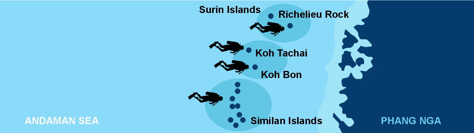
Similan Dive Guide for the provision of the map.


")
")
")
")
")


")
")


")
")
")

")